Mount Chokai and Kisakata: Kujukushima, Mototaki and Hottai Falls
This guide is translated from the Japanese edition. Read the Japanese edition
Around the Akita side of Mount Chokai: Kisakata's Kujukushima islets, mossy Mototaki spring falls, Shishigahana Wetland's beech forest and three-tiered Hottai Falls.
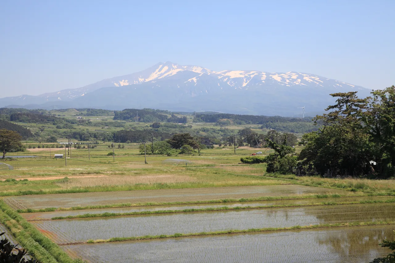
In May in Kisakata, after the rice has been planted, Mount Chokai still wears its snow beyond the flooded paddies. Mount Chokai rises 2,236 m on the border of Akita and Yamagata. At its foot are waterfalls and forests fed by snowmelt that has soaked into the mountain, a waterfall that drops over a lava cliff, and islets that once floated in the sea. The five sights below are in Nikaho City and Yurihonjo City on the Akita side, and are best reached by car.
What Is the Kisakata and Mount Chokai Area Like?
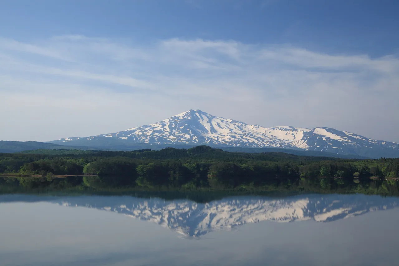
Mount Chokai is the second-highest mountain in Tohoku, and its long, symmetrical slopes have earned it the name "Dewa Fuji." On the north side of the mountain, Kisakata in Nikaho City has the small islets in the rice fields known as Kujukushima, along with spring-fed forests such as Mototaki Falls and Shishigahana Wetland. To the northeast, the Chokai and Yashima areas of Yurihonjo City have Hottai Falls and the Haraikawa trailhead.
The nearest station is Kisakata Station on the JR Uetsu Line, but only the area around Kujukushima is walkable from it. Mototaki Falls and Shishigahana Wetland are about 20 minutes by car from Kisakata Station, and Hottai Falls is about 50 minutes by car from Yashima Station on the Yuri Kogen Railway, so getting around by local bus is difficult. Plan to drive a rental car from Akita City, or to use taxis or reservation-based shared taxis around Kisakata.
Kisakata's Kujukushima: Pine-Topped Islets in the Rice Fields
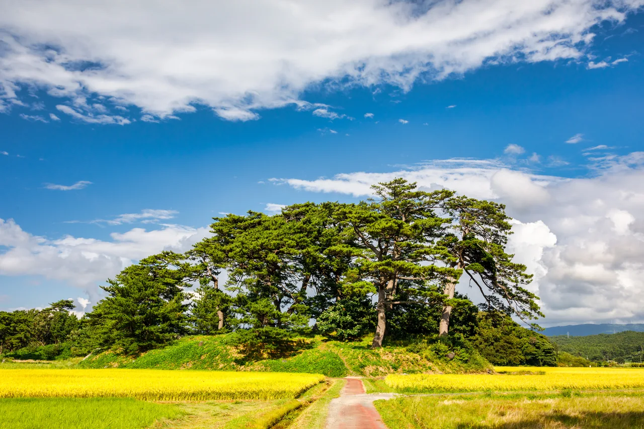
Kisakata's Kujukushima is a landscape of small pine-topped mounds scattered across rice fields. It was once a scenic inlet dotted with islands, spoken of in the same breath as Matsushima. In 1689 (Genroku 2), the poet Matsuo Basho visited on the journey he recorded in "The Narrow Road to the Deep North," toured the islands by boat and wrote the haiku "Kisakata ya / ame ni Seishi ga / nebu no hana" ("Kisakata: in the rain, Xi Shi and the silk-tree blossoms").
Then in 1804 (Bunka 1), a major earthquake lifted the land and the inlet became dry ground. The lagoon gradually turned into rice paddies, and today about 65 mounds that were once islands remain among the fields, designated a national Natural Monument under the name "Kisakata." When the paddies are flooded in spring, the islets seem to float on water again, and you can picture the old lagoon. In autumn, the green of the pines rises from golden rice.
A walking course loops around the islets between the paddies, with a guide map posted. The fields belong to farmers, so stay off the narrow ridges between paddies and view them from the walking path or the road.
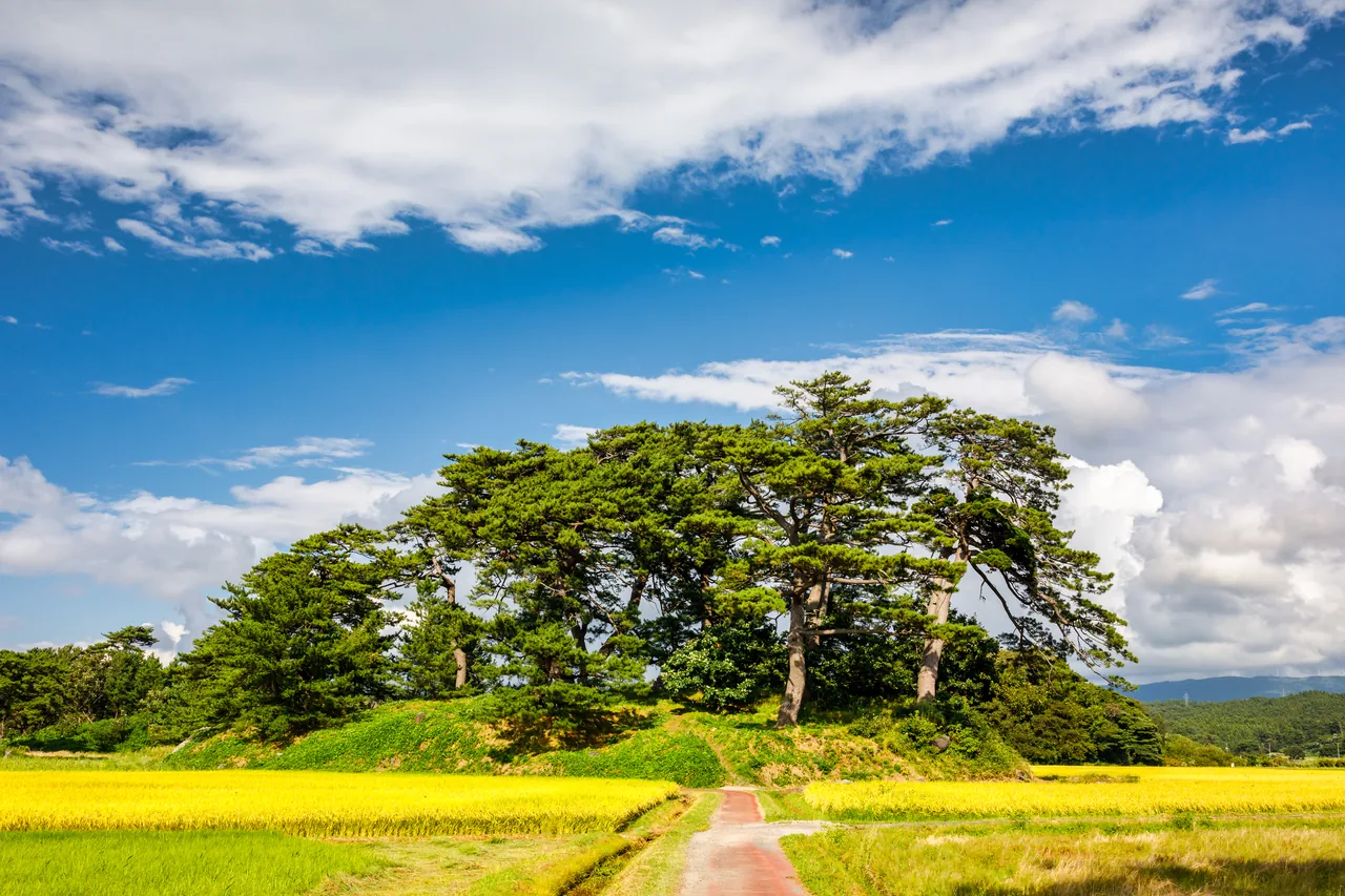
Photo: Akita Prefecture
Mototaki Falls: Water Spilling from a Mossy Rock Wall
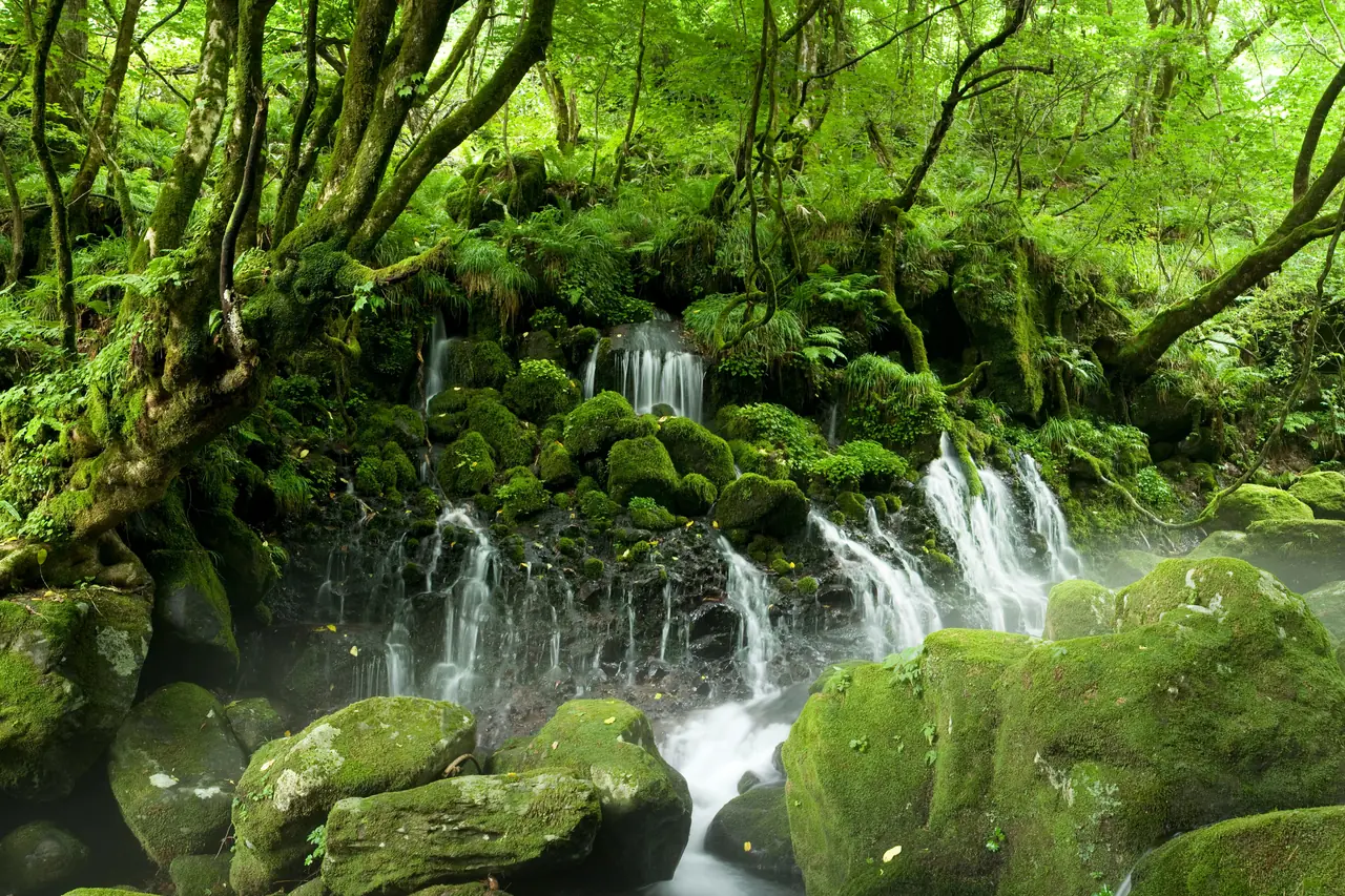
Mototaki Falls is not a waterfall where a river drops from above. Instead, water springs from all over a moss-covered rock wall about 30 m wide and flows down in white threads. According to the Ministry of the Environment, about 50,000 tons of water emerge each day. The snow and rain that fall on Mount Chokai are said to take about 80 years to flow underground before surfacing here, and the spring is one of the Ministry's "100 Exquisite Waters of the Heisei Era."
From the parking lot, a path through riverside woods brings you to the falls in about 10 minutes. Even on a sunny summer day it feels cool in front of the falls, and the moss glows bright green in the dappled light. Bears have been sighted in the area, and the path has at times been temporarily closed. Check notices from the Nikaho City Tourism Association before you go.
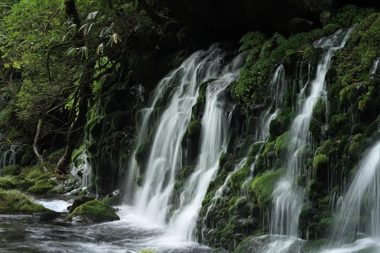
Photo: Akita Prefecture
Nakajimadai and Shishigahana Wetland: A Beech Forest Ruled by the Agariko King
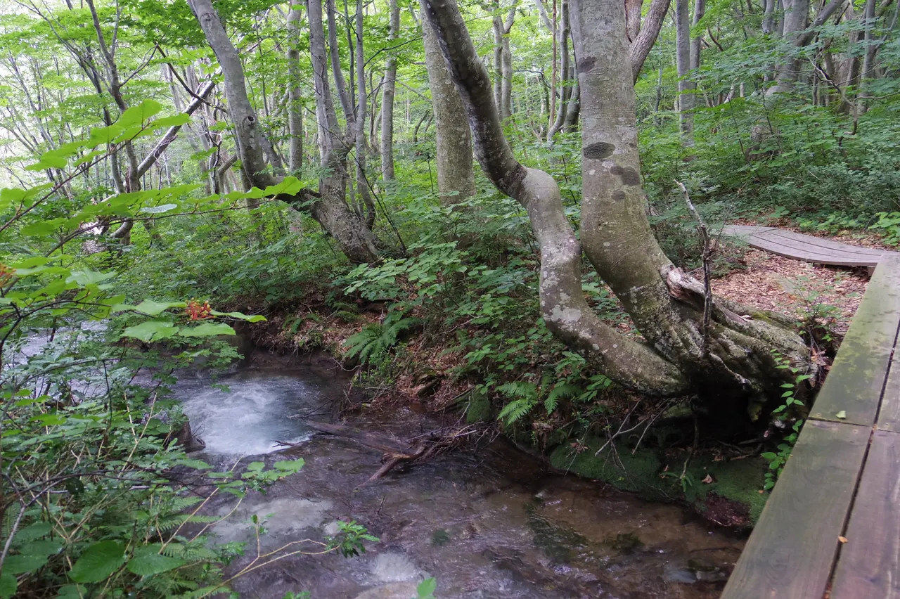
Nakajimadai and Shishigahana Wetland, at the northern foot of Mount Chokai, is a wetland and beech forest formed by water springing up all over the woods. Its wetland plant communities and springs are designated a national Natural Monument. Boardwalks lead you past the spring pond Detsubo and the "Chokai marimo," moss that has grown into balls.
From the end of the Edo period into the Showa period, the beeches here had their branches cut for charcoal making. New shoots sprouted from the cuts, and the trees took on an unusual shape, with branches spreading in all directions from the top of a thick trunk. Trees of this shape are called agariko, and the "Agariko King," about 300 years old with a trunk 7.62 m around, stands like the lord of the forest.
The trail loop is about 5 km and takes a little over two hours at an easy pace. Parts of the boardwalk are sometimes closed for repairs, and the whole area is bear habitat. The Nikaho City Tourism Association recommends walking with a geo-guide (paid) who knows the local nature and history. There is a free parking lot at the entrance, the Nakajimadai Recreation Forest, about 20 minutes by car from Kisakata Station.
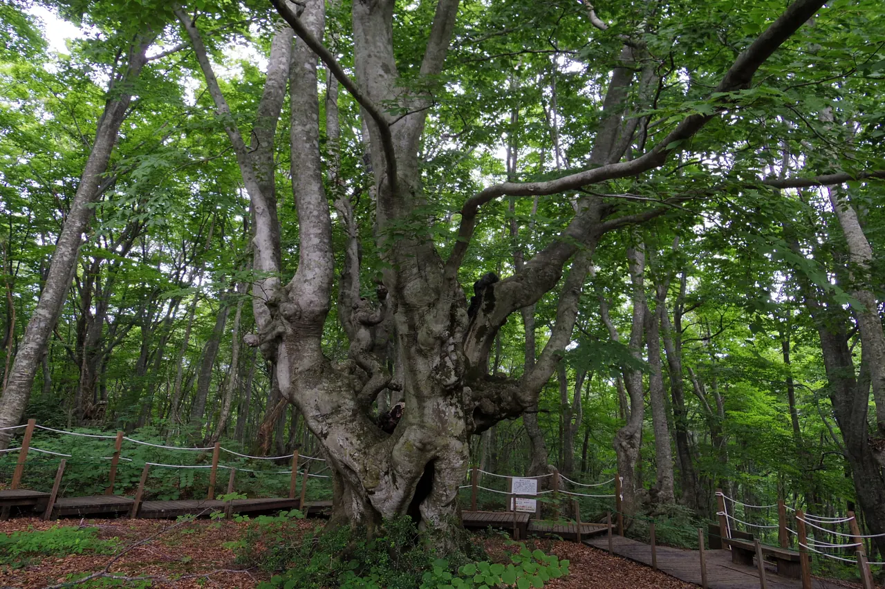
Photo: Akita Prefecture
Hottai Falls: Three Tiers over a Lava Cliff
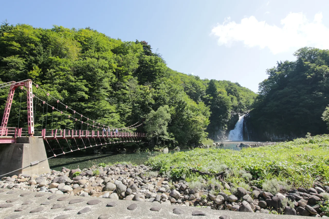
Hottai Falls, in the mountains of the Chokai area of Yurihonjo City, drops about 57 m and is one of Japan's Top 100 Waterfalls. The river falls in three tiers, the first, second and third falls, over a cliff formed by lava from an eruption of Mount Chokai about 100,000 years ago. Together with the round potholes worn into the rock upstream, the falls are a Place of Scenic Beauty and Natural Monument of Akita Prefecture.
From the riverbed you can see the third fall head-on, and a path beyond the red suspension bridge climbs to an observation deck overlooking all three tiers. The area around the falls is closed for winter from late November to early May. It's about 50 minutes by car from Yashima Station on the Yuri Kogen Railway, or about 1 hour 10 minutes from the Honjo Interchange on the Nihonkai-Tohoku Expressway.
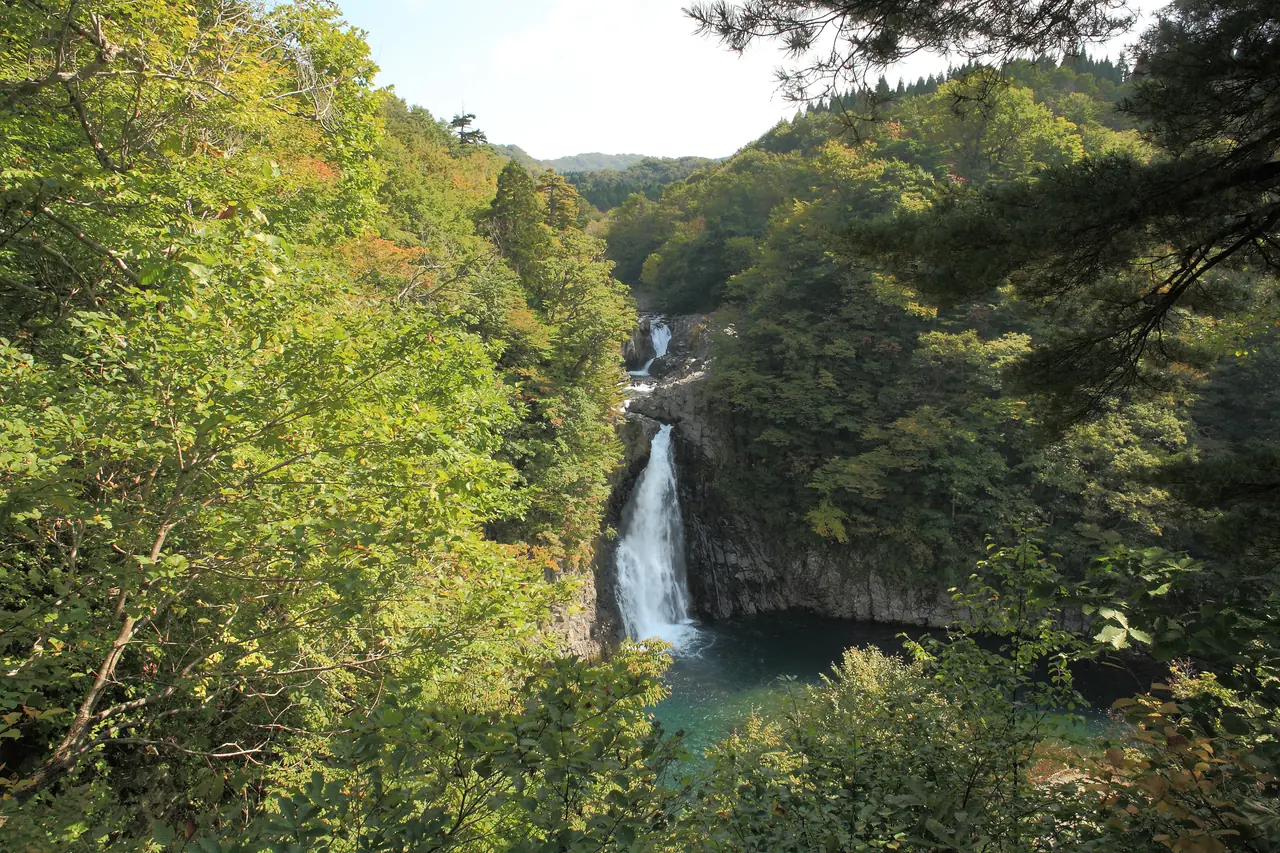
Photo: Akita Prefecture
Mount Chokai: Admire It from Below, Drive Up to the Fifth Station
Mount Chokai can be enjoyed without climbing it. In May and June, even after the forests at its foot turn fresh green, thick snow remains on its upper slopes. Around May, when the paddies are flooded, the snowy mountain is reflected in the water on still days.
There are two roads that take you close to the mountain by car. From the Kisakata Interchange area in Nikaho City, the mountain road Chokai Blue Line climbs to Hokodate. On the Yurihonjo side, you can drive to Haraikawa at the fifth station, where the Yashima Trail, the oldest climbing route on the Akita side, begins; the Ryugahara Wetland, a raised bog, is right next to it. From Haraikawa to Shichikozan on the summit is about 4.4 km. If you plan to climb, bring proper gear and allow plenty of time.
Both roads close in winter. For 2026, the Chokai Blue Line was announced to close at night from late October and to enter its winter closure from the evening of November 4. Spring opening dates also change from year to year.
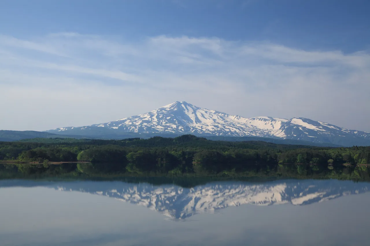
Photo: Akita Prefecture
How to Get Around: Seasons and Safety
The three sights around Kisakata are close together, so you can walk Kujukushima and then drive on to Mototaki Falls and Shishigahana Wetland. The Shishigahana trail takes a little over two hours, so leave yourself plenty of time. Hottai Falls is far from Kisakata, so one option is to visit it on a separate day together with Haraikawa and the Ryugahara Wetland on the Yashima side.
- Best season: From when the mountain roads open in spring until the autumn leaves. Hottai Falls is closed from late November to early May, and the Chokai Blue Line and the road to Haraikawa are closed through winter.
- Bear safety: Mototaki Falls, Shishigahana Wetland and Hottai Falls are all in forests. Carry a bell and check in advance whether any paths are closed.
- Footwear: The spring-fed forests have wet, slippery spots underfoot. Wear comfortable walking shoes.
For the latest road information and notices, see the websites of the Nikaho City Tourism Association and Yurihonjo City. Find more places to visit in Akita on the Akita search page.